
Page 117 - LIT-18626-13-49
P. 117
SportsBoat_F3R15.book Page 108 Friday, May 14, 2021 11:12 AM
Instrument operation
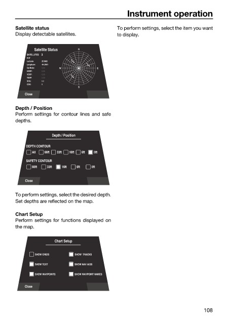
Satellite status To perform settings, select the item you want
Display detectable satellites. to display.
Satellite Status N
SATELLITES 3
9:47
Latitude: 35.6060
Longitude: -84.2541
Op Mode: 0.00 W E
HDOP: 0.00
VDOP: 0.00
TDOP: 0.00
SOG: 0.0
COG: 0
S
Close
Depth / Position
Perform settings for contour lines and safe
depths.
Depth / Position
DEPTH CONTOUR
All 66ft 33ft 16ft 6ft 0ft
SAFETY CONTOUR
66ft 33ft 16ft 6ft 0ft
Close
To perform settings, select the desired depth.
Set depths are reflected on the map.
Chart Setup
Perform settings for functions displayed on
the map.
Chart Setup
SHOW GRIDS SHOW TRACKS
SHOW TEXT SHOW NAV AIDS
SHOW WAYPOINTS SHOW WAYPOINT NAMES
Close
108