
Page 64 - LIT-18626-14-04
P. 64
SportsBoat_F4V14.book Page 56 Tuesday, July 5, 2022 2:34 PM
Instrument operation
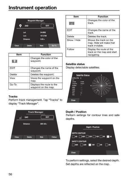
Item Function
Waypoint Manager Changes the color of the
track.
AAD EDIT
EDIT Changes the name of the
Lat: 34.6892 track.
Lon: 137.5789 Delete Deletes the track.
Distance: 0.62 Ft.
Show / Hide Shows the track on the
map. Hide will make that
Close Delete View Go-To track invisible.
Follow Display the route of the
track on the map and start
Item Function navigating.
Changes the color of the
waypoint.
Satellite status
EDIT Changes the name of the Display detectable satellites.
waypoint.
Delete Deletes the waypoint.
Satellite Status N
View Views the waypoint on the SATELLITES 3
9:47
map.
Latitude: 35.6060
Longitude: -84.2541
Go-To Displays the route to the
Op Mode: 0.00 W E
waypoint on the map. HDOP: 0.00
VDOP: 0.00
TDOP: 0.00
SOG: 0.0
COG: 0
Tracks S
Perform track management. Tap “Tracks” to Close
display “Track Manager”.
Track Manager Depth / Position
Perform settings for contour lines and safe
EAC EDIT
depths.
Distance: 2651.68 ft
Depth / Position
DEPTH CONTOUR
Close Delete Hide Follow All 66ft 33ft 16ft 6ft 0ft
SAFETY CONTOUR
66ft 33ft 16ft 6ft 0ft
Close
To perform settings, select the desired depth.
Set depths are reflected on the map.
56